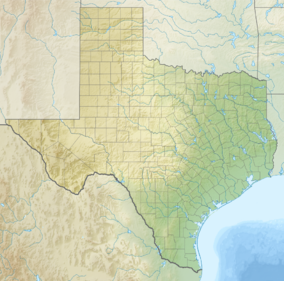
Amistad National Recreation Area is a national recreation area managed by National Park Service (NPS) that includes the area around the Amistad Reservoir at the confluence of the Rio Grande, the Devils River, and the Pecos River near Del Rio in Val Verde County, Texas.[3] The reservoir was created by the Amistad Dam (Presa de la Amistad in Spanish), completed in 1969, located on the Rio Grande at the United States-Mexico border across from the city of Ciudad Acuña in the Mexican state of Coahuila. Amistad, Spanish for "friendship," refers broadly to the close relationship and shared history between Ciudad Acuña and Del Rio.[4]
| Amistad National Recreation Area | |
|---|---|
 Southern Pacific Railroad Bridge over Amistad Reservoir | |
| Location | Val Verde County, Texas, USA |
| Nearest city | Del Rio, Texas |
| Coordinates | 29°26′12″N 101°3′0″W / 29.43667°N 101.05000°W |
| Area | 58,500 acres (237 km2)[1] |
| Established | November 11, 1965 |
| Visitors | 912,283 (in 2022)[2] |
| Governing body | National Park Service |
| Website | Amistad National Recreation Area |


Recreational activities
editThe lake given its location is the backdrop for year-round, water-based recreation opportunities, including boating, fishing, swimming, scuba diving and water-skiing.[5] Houseboats and other boating equipment can be rented from the park unit's concessionaires.[6] Amistad National Recreation Area in addition provides opportunities for picnicking, hiking, camping and hunting.[5] The area is rich in archeology and rock art, and contains a wide variety of plant and animal life.[5] In the fall, monarch butterflies by the thousands pass through the area during their 3,000 mile (4,800 km) migration from southern Canada to central Mexico.[7]
There are opportunities for hunting as provided for under state and federal law at Amistad given its status as a recreation area.[8] Bow-hunting for white-tailed deer, javelina, turkey, rabbit, mouflon sheep, aoudad sheep, blackbuck antelope and feral hog is permitted during certain times of the year in prescribed hunt areas.[9] Though rifles and handguns are not permitted, shotguns may be used to hunt dove, quail, duck and rabbit in accordance with relevant regulations.[9]
Elite scuba divers have begun to explore the system of deep underwater caves beneath the surface of the reservoir.[10] The dive requires exotic gas mixes, pre-placement of gas cylinders, and extensive decompression times at depth.[10] These caves are considered hazardous and should not be attempted by anyone without extensive training and preparation.[10]
Administrative history
editThe National Park Service initially managed the site as the Amistad Recreation Area under a cooperative agreement with the International Boundary and Water Commission effective November 11, 1965.[11] Amistad was reauthorized as a national recreation area and NPS park unit on November 28, 1990.[11]
Gallery
edit-
Cattle egret (Bubulcus ibis) near the reservoir
-
Panther petroglyph located in Panther Cave jointly managed with Seminole Canyon State Park and Historic Site[12]
-
Monarch butterflies (Danaus plexippus) roosting in the fall on their migration south to Mexico[7]
References
edit- ^ "Listing of acreage – December 31, 2011" (XLSX). Land Resource Division, National Park Service. Retrieved 2012-03-30. (National Park Service Acreage Reports)
- ^ "NPS Annual Recreation Visits Report". National Park Service. Retrieved July 26, 2023.
- ^ "Amistad". National Parks Conservation Association. Retrieved 2021-09-05.
- ^ "Discover Our Shared Heritage Travel Itinerary: American Latino Heritage: Amistad National Recreation Area, Val Verde County, Texas". National Park Service. Retrieved 2013-11-27.
- ^ a b c "Chihuahuan Desert Paradise" (PDF). The High Bridge Tribune. National Park Service. Winter 2005–2006. Retrieved 2013-11-27.
- ^ "Texas Houseboating and Texas Houseboat Rentals". texasoutside.com. Retrieved 2013-11-27.
- ^ a b "Monarch Butterflies Migrate Through Amistad NRA" (PDF). The High Bridge Tribune. National Park Service. Winter 2005–2006. Retrieved 2013-11-28.
- ^ "Public Law 101-628, 104 Stat. 4492, section 506(d)" (PDF). National Park Service. 1990-11-28. Retrieved 2013-11-28.
- ^ a b "Hunting: Amistad National Recreation Area". National Park Service.
- ^ a b c Nadler-Olenick, Rae (December 2011). "DEEP, DARK AND DANGEROUS: The nation's deepest known underwater cave system lures expert divers". Texas Parks and Wildlife. Retrieved 2013-11-27.
- ^ a b "The National Parks Index 2009-2011". National Park Service. Retrieved 2013-11-27.
- ^ "How To See Rock Art: Amistad National Recreation Area". National Park Service. Retrieved 2013-11-27.
External links
edit- Official NPS site: Amistad National Recreation Area
- Archival film footage of the Amistad Dam and Reservoir from the Texas Archive of the Moving Image

