Size of this PNG preview of this SVG file: 512 × 473 pixels. Other resolutions: 260 × 240 pixels | 520 × 480 pixels | 831 × 768 pixels | 1,108 × 1,024 pixels | 2,217 × 2,048 pixels.
Original file (SVG file, nominally 512 × 473 pixels, file size: 301 KB)
File history
Click on a date/time to view the file as it appeared at that time.
| Date/Time | Thumbnail | Dimensions | User | Comment | |
|---|---|---|---|---|---|
| current | 14:37, 10 December 2010 |  | 512 × 473 (301 KB) | Miguillen | colores según convención |
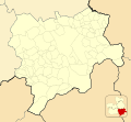
| 09:02, 15 November 2010 |  | 512 × 473 (175 KB) | Miguillen | == {{int:filedesc}} == {{Information |Description={{en|Location map of Province of Albacete}} Equirectangular projection, N/S stretching 130 %. Geographic limits of the map: * N: ° N * S: ° N * W: ° O * E: ° O {{es|Ma |
File usage
The following 10 pages use this file:
Global file usage
The following other wikis use this file:
- Usage on ar.wikipedia.org
- Usage on ast.wikipedia.org
- Usage on ba.wikipedia.org
- Usage on ceb.wikipedia.org
- Usage on eo.wikipedia.org
- Villarrobledo
- Almansa
- Provinco Albaceto
- Hellín
- Ŝablono:Situo sur mapo Hispanio Provinco Albaceto
- Caudete
- Pozuelo
- Minaya
- La Roda
- La Gineta
- Albacete Los Llanos (stacidomo)
- Caudete (stacidomo)
- Almansa (stacidomo)
- La Roda de Albacete (stacidomo)
- Villarrobledo (stacidomo)
- La Gineta (stacidomo)
- Minaya (stacidomo)
- Hellín (stacidomo)
- Usage on es.wikipedia.org
View more global usage of this file.