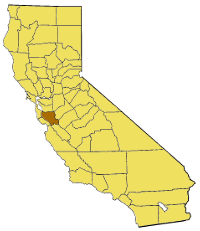
California_map_showing_Santa_Clara_County.png (200 × 231 pixels, file size: 28 KB, MIME type: image/png)
File history
Click on a date/time to view the file as it appeared at that time.
| Date/Time | Thumbnail | Dimensions | User | Comment | |
|---|---|---|---|---|---|
| current | 02:21, 18 August 2009 |  | 200 × 231 (28 KB) | Droll | {{Information |Description===Replacement for California map showing Santa Clara County== |Source=*File:California_map_showing_counties_(source).xcf |Date=2009-08-18 02:15 (UTC) |Author=*File:California_map_showing_counties_(source).xcf: w:User |
File usage
The following 72 pages use this file:
- Affordable housing in Silicon Valley
- Agnew's Village, California
- Ashrama, California
- Bear Mountain (Santa Clara County, California)
- Bing Concert Hall
- Black Mountain (Milpitas, California)
- Burnt Hills
- Calaveras Valley
- Canoas Creek (Santa Clara County)
- Casa de Fruta
- Cañada Garcia Creek
- Charleston Slough
- Chinese Cultural Garden
- Coyote Lake (Santa Clara County, California)
- Crystal Peak (Santa Clara County, California)
- Eastman Canyon Creek
- Ed R. Levin County Park
- Edenvale Gardens Regional Park
- El Sereno Open Space Preserve
- El Toro (California)
- Foothills Open Space Preserve
- Guadalupe Reservoir
- Hagerman Peak
- Hellyer County Park
- John W. Christian Greenbelt
- Joseph D. Grant County Park
- Lake Cunningham
- Lake Elsman
- Lions Peak
- Little Uvas Creek
- Los Buellis Hills
- Los Gatos Creek Park
- Meadowfair, San Jose
- Miguelita Creek
- Mississippi Creek
- Monument Peak (Milpitas, California)
- Mount Bielawski
- Mount Chual
- Mount Madonna
- Mount Mocho
- Mount Sizer
- Mount Stakes
- Máyyan 'Ooyákma – Coyote Ridge Open Space Preserve
- North San Jose
- Oak Ridge (California)
- Ogilvie Island
- Overfelt Gardens
- Poverty Ridge
- Qmunity District
- San Felipe Hills (Santa Clara County)
- San Jose Steam Railroad Museum
- San Juan Bautista Hills
- San Pedro Square
- Santa Clara Valley Open Space Authority
- Saratoga Gap Open Space Preserve
- Sierra Azul
- Silver Creek Fault
- Silver Creek Valley
- Spartan Keyes, San Jose
- Sveadal, California
- Sycamore Creek (Santa Clara County)
- Tulare Hill
- Twin Peaks (Santa Clara County, California)
- Uvas Canyon County Park
- Uvas Falls
- Vasona Reservoir
- Washington-Guadalupe, San Jose
- West San Jose
- Winchester, San Jose
- World Publications
- User:Wahn/Little Uvas Creek
- Template:SantaClaraCountyCA-geo-stub
Global file usage
The following other wikis use this file:
- Usage on bg.wikipedia.org
- Usage on li.wikipedia.org
- Usage on www.wikidata.org

