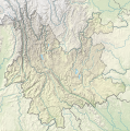
Size of this PNG preview of this SVG file: 596 × 599 pixels. Other resolutions: 239 × 240 pixels | 477 × 480 pixels | 764 × 768 pixels | 1,019 × 1,024 pixels | 2,037 × 2,048 pixels | 1,318 × 1,325 pixels.
Original file (SVG file, nominally 1,318 × 1,325 pixels, file size: 1.15 MB)
File history
Click on a date/time to view the file as it appeared at that time.
| Date/Time | Thumbnail | Dimensions | User | Comment | |
|---|---|---|---|---|---|
| current | 19:18, 4 May 2024 |  | 1,318 × 1,325 (1.15 MB) | NordNordWest | == {{int:filedesc}} == {{Information |Description= {{de|1=Positionskarte von Yunnan, Volksrepublik China}} {{en|1=Location map of Yunnan, People's Republic of China}} {{Location map series N |stretching=110 |top=29.5 |bottom=21.0 |left=97.2 |right=106.5 }} |Source={{Own using}} * United States National Imagery and Mapping Agency data * World Data Base II data * ETOPO1 data |Date=2024-05-04 |Author={{U|NordNordWest}} |Permission= |other_versions=<gallery>China Yunnan adm location map.svg</gall... |
File usage
The following 66 pages use this file:
- 1833 Kunming earthquake
- 1913 Eshan earthquake
- 1970 Tonghai earthquake
- 1974 Zhaotong earthquake
- 1988 Lancang–Gengma earthquakes
- 2003 Dayao earthquake
- 2006 Yanjin earthquake
- 2011 Yunnan earthquake
- 2012 Yiliang earthquakes
- 2014 Jinggu earthquake
- 2014 Yingjiang earthquake
- 2020 Qiaojia earthquake
- 2021 Dali earthquake
- Bita Lake
- Black Dragon Pool
- Chang Lake (Yunnan)
- Chenghai Lake
- Chuanjie Formation
- Cibi Lake
- Dian Lake
- Erhai Lake
- Fengjiahe Formation
- Fuxian Lake
- Honghe Hani Rice Terraces
- Jade Dragon Snow Mountain
- Jiaozi Snow Mountain
- Kawagarbo
- Lashihai Wetland
- Longma Dam
- Lufeng Formation
- Lugu Lake
- Meili Snow Mountains
- Mingyong Glacier
- Mount Jizu
- Old Town of Lijiang
- Qilu Lake
- Shudu Lake
- Tengchong volcanic field
- Three Parallel Rivers
- West Lake (Eryuan)
- Xingyun Lake
- Yangzong Lake
- Yilong Lake
- Zhangjiu River
- User:Jarda2020/2022 Dali earthquake
- User:Ty654/List of earthquakes before 1900 exceeding magnitude 8+
- User:Ty654/List of earthquakes from 1900-1949 exceeding magnitude 7+
- User:Ty654/List of earthquakes from 1910-1919 exceeding magnitude 6+
- User:Ty654/List of earthquakes from 1920-1929 exceeding magnitude 6+
- User:Ty654/List of earthquakes from 1930-1939 exceeding magnitude 6+
- User:Ty654/List of earthquakes from 1940-1949 exceeding magnitude 6+
- User:Ty654/List of earthquakes from 1950-1954 exceeding magnitude 6+
- User:Ty654/List of earthquakes from 1950-1999 exceeding magnitude 7+
- User:Ty654/List of earthquakes from 1955-1959 exceeding magnitude 6+
- User:Ty654/List of earthquakes from 1960-1964 exceeding magnitude 6+
- User:Ty654/List of earthquakes from 1965-1969 exceeding magnitude 6+
- User:Ty654/List of earthquakes from 1970-1974 exceeding magnitude 6+
- User:Ty654/List of earthquakes from 1975-1979 exceeding magnitude 6+
- User:Ty654/List of earthquakes from 1985-1989 exceeding magnitude 6+
- User:Ty654/List of earthquakes from 1995-1999 exceeding magnitude 6+
- User:Ty654/List of earthquakes from 2000-2004 exceeding magnitude 6+
- User:Ty654/List of earthquakes from 2005-2009 exceeding magnitude 6+
- User:Ty654/List of earthquakes from 2010-2014 exceeding magnitude 6+
- Module:Location map/data/China Yunnan
- Module:Location map/data/China Yunnan/doc
- Module:Location map/data/Yunnan
Global file usage
The following other wikis use this file:
- Usage on de.wikipedia.org
- Yulong Xueshan
- Xingyun-See
- Manwan-Talsperre
- Wasserkraftwerk Shilongba
- Fuxian Hu
- Chenghai (See)
- Diancang Shan
- Wikipedia:Kartenwerkstatt/Positionskarten/Asien
- Dian Chi
- Vorlage:Positionskarte China Yunnan
- Bamei-Tal
- Wumeng Shan
- Er Hai
- Jinanqiao-Talsperre
- Nuozhadu-Talsperre
- Ailao Shan
- Yun Ling
- Nu Shan
- Gaoligong Shan
- Jizu Shan
- Wuliang Shan
- Tigersprung-Schlucht
- Ahai-Talsperre
- Daxue Shan (Yunnan)
- Usage on fr.wikipedia.org
- Usage on he.wikipedia.org
- Usage on uk.wikipedia.org
- Usage on zh.wikipedia.org
View more global usage of this file.


