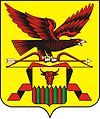
Size of this PNG preview of this SVG file: 504 × 599 pixels. Other resolutions: 202 × 240 pixels | 404 × 480 pixels | 646 × 768 pixels | 861 × 1,024 pixels | 1,723 × 2,048 pixels | 757 × 900 pixels.
Original file (SVG file, nominally 757 × 900 pixels, file size: 80 KB)
File history
Click on a date/time to view the file as it appeared at that time.
| Date/Time | Thumbnail | Dimensions | User | Comment | |
|---|---|---|---|---|---|
| current | 15:06, 4 October 2012 |  | 757 × 900 (80 KB) | Popadius | {{Information |Description ={{en|1=Coat of arms of Zabaykalsky Krai.}} {{ru|1=Герб Забайкальского края.}} |Source ={{own based}} {{F|Chita Oblast coat of arms.jpg}} |Author ={{u|Popadius}} |Date =2012-... |
File usage
The following 11 pages use this file:
- Armorial of Russia
- Chita Oblast
- Far Eastern Federal District
- Federal subjects of Russia
- Governor of Zabaykalsky Krai
- Legislative Assembly of Zabaykalsky Krai
- List of first-level administrative divisions by area
- List of heads of federal subjects of Russia
- Zabaykalsky Krai
- User:Shrejmann
- User:Treetoes023/List of the largest country subdivisions by area
Global file usage
The following other wikis use this file:
- Usage on af.wikipedia.org
- Usage on ar.wikipedia.org
- Usage on arz.wikipedia.org
- Usage on ast.wikipedia.org
- Usage on azb.wikipedia.org
- Usage on az.wikipedia.org
- Usage on ba.wikipedia.org
- Usage on be-tarask.wikipedia.org
- Usage on be.wikipedia.org
- Чыта
- Чыцінская вобласць
- Балей
- Борзя
- Краснакаменск
- Пятроўск-Забайкальскі
- Магоча
- Шылка (горад)
- Хілок
- Срэценск
- Нерчынск
- Забайкальскі край
- Агінскае (Забайкальскі край)
- Магойтуй
- Чарнышэўск
- Суб’екты Расійскай Федэрацыі
- Забайкальск
- Атаманаўка
- Дульдурга
- Прыаргунск
- Верх-Усуглі
- Горны (Забайкальскі край)
- Шаблон:Забайкальскі край
- Амазар
- Усць-Карск
- Яснагорск (Забайкальскі край)
- Букачача
- Арлоўскі (Забайкальскі край)
- Дарасун
- Жырэкен
- Ітака (Забайкальскі край)
- Магзон
- Залатарэчанск
View more global usage of this file.


