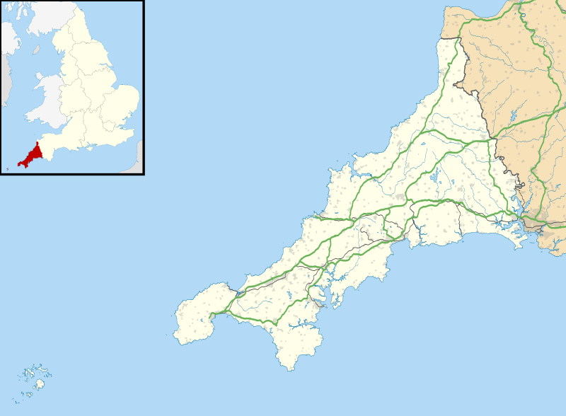
Size of this PNG preview of this SVG file: 800 × 588 pixels. Other resolutions: 320 × 235 pixels | 640 × 471 pixels | 1,024 × 753 pixels | 1,280 × 941 pixels | 2,560 × 1,883 pixels | 1,425 × 1,048 pixels.
Original file (SVG file, nominally 1,425 × 1,048 pixels, file size: 1.66 MB)
File history
Click on a date/time to view the file as it appeared at that time.
| Date/Time | Thumbnail | Dimensions | User | Comment | |
|---|---|---|---|---|---|
| current | 18:43, 26 September 2010 |  | 1,425 × 1,048 (1.66 MB) | Nilfanion | {{Information |Description=Map of Cornwall, UK with the following information shown: *Administrative borders *Coastline, lakes and rivers *Roads and railways *Urban areas Equirectangular map projection on WGS 84 datum, with N/S stretched 1 |
File usage
More than 100 pages use this file. The following list shows the first 100 pages that use this file only. A full list is available.
- Antony House
- Bodmin Airfield
- Bodmin Hospital
- Bokiddick
- Bonython Manor
- Boskenna
- Bossiney Haven
- Botallack Mine
- Brisons
- Camborne Redruth Community Hospital
- Camborne School of Mines
- Caradon Hill transmitting station
- Carn Brea, Redruth
- Castle Horneck
- Church of St Morwenna and St John the Baptist, Morwenstow
- Chûn Castle
- Cornish rotten and pocket boroughs
- Cotehele
- Dupath Well
- Geevor Tin Mine
- Godolphin Estate
- Goldsithney
- HMS Raleigh (shore establishment)
- Hall for Cornwall
- Hawker's Hut
- Headland Hotel
- Ince Castle
- Jamaica Inn
- John Knill
- King Doniert's Stone
- Lanhydrock House
- Launceston Castle
- Lawrence House, Launceston
- Levant Mine and Beam Engine
- List of lighthouses in England
- List of monastic houses in Cornwall
- List of places in Cornwall
- Lostwithiel Stannary Palace
- Mining Exchange
- Mount Edgcumbe Country Park
- Mount Edgcumbe House
- Mount Wellington Tin Mine
- Newquay Airport
- Nine Maidens stone row
- Pencarrow
- Pendennis Castle
- Penhallam
- Penlee Battery
- Penpol, Lesnewth
- Penryn Campus
- Perranporth Airfield
- Picklecombe Fort
- Place House
- Poldice mine
- Port Eliot
- Predannack Airfield
- Prideaux Place
- RAF Cleave
- RAF Davidstow Moor
- RAF Perranporth
- RAF St Eval
- RAF St Mawgan
- RNAS Culdrose (HMS Seahawk)
- RRH Portreath
- Redruth transmitting station
- Restormel Castle
- Rillaton Barrow
- Roseland Peninsula
- Royal Cornwall Hospital
- Runnel Stone
- Scraesdon Fort
- South Crofty
- St Bartholomew's Church, Lostwithiel
- St Buryan's Church
- St Carantoc's Church, Crantock
- St Catherine's Castle
- St Enodoc's Church, Trebetherick
- St Ervan
- St Germans Priory
- St Mawes Castle
- St Michael's Hospital, Hayle
- The Hurlers (stone circles)
- Tintagel Castle
- Tolverne Cottage
- Tregantle Fort
- Tregarden
- Tregenna Castle
- Tregothnan
- Trelissick
- Trematon Castle
- Trengwainton Garden
- Trerice
- Treryn Dinas
- Trethevy Quoit
- Trevenson
- Trinity House National Lighthouse Museum
- Truro Aerodrome
- Truro Cathedral
- West Cornwall Hospital
- Wheal Jane
View more links to this file.
Global file usage
The following other wikis use this file:
- Usage on ar.wikipedia.org
- Usage on bg.wikipedia.org
- Usage on ceb.wikipedia.org
- Usage on es.wikipedia.org
- Islas Sorlingas
- Truro
- Plantilla discusión:Ficha de isla
- Catedral de Truro
- Bahía de Carbis
- Aeropuerto de Newquay Cornwall
- Hugh Town
- Plantilla:Mapa de localización de Cornualles
- St Ives (Cornualles)
- Bodmin
- St Austell
- Boscastle
- Ashton (Cornualles)
- Blackwater (Cornualles)
- Four Lanes
- Gerrans
- Fowey
- Godolphin Cross
- Mabe Burnthouse
- Goldsithney
- Madron
- Goonhavern
- Breage
- Gorran Haven
- Grampound
- Gunnislake
- Grampound Road
- Marazion
- Gweek
- Harrowbarrow
- Bude (Inglaterra)
- Marhamchurch
- Mawnan Smith
- Menheniot
- Hayle
- Mevagissey
- Helston
- Calstock
- Bugle (Inglaterra)
- Camelford
- Higher Boscaswell
- Callington
- Port Gaverne
- Millbrook (Cornualles)
- Mousehole
- Mount Hawke
- Indian Queens (St Columb Road)
View more global usage of this file.