Size of this preview: 476 × 600 pixels. Other resolutions: 190 × 240 pixels | 592 × 746 pixels.
Original file (592 × 746 pixels, file size: 838 KB, MIME type: image/jpeg)
File history
Click on a date/time to view the file as it appeared at that time.
| Date/Time | Thumbnail | Dimensions | User | Comment | |
|---|---|---|---|---|---|
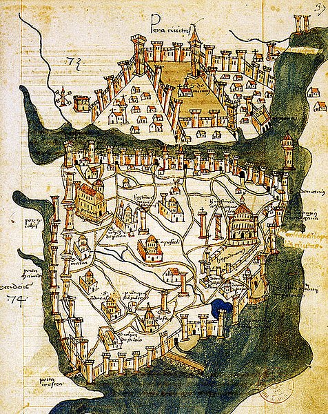
| current | 10:24, 25 June 2007 |  | 592 × 746 (838 KB) | M.K. | {{Information |Description=Map of Constantinople (1422) by Florentine cartographer Cristoforo Buondelmonte (''Description des îles de l'archipel'', Bibliothèque nationale, Paris) is the oldest surviving map of the city, and the only surviving ma |
File usage
The following 13 pages use this file:
- Beyoğlu
- Bosporus
- Constantine XI Palaiologos
- Constantinople
- John VII Palaiologos
- Maiden's Tower
- Piyalepaşa, Beyoğlu
- Siege of Constantinople (1394–1402)
- Siege of Constantinople (1411)
- Siege of Constantinople (1422)
- Walls of Constantinople
- Wikipedia:Main Page history/2019 February 23
- Template:Did you know nominations/Kontoskalion
Global file usage
The following other wikis use this file:
- Usage on ar.wikipedia.org
- Usage on az.wikipedia.org
- Usage on ba.wikipedia.org
- Usage on bg.wikipedia.org
- Usage on ca.wikipedia.org
- Usage on cs.wikipedia.org
- Usage on de.wikipedia.org
- Usage on el.wikipedia.org
- Usage on es.wikipedia.org
- Usage on et.wikipedia.org
- Usage on eu.wikipedia.org
- Usage on fa.wikipedia.org
- Usage on frp.wikipedia.org
- Usage on fr.wikipedia.org
- Usage on gl.wikipedia.org
- Usage on he.wikipedia.org
- Usage on hy.wikipedia.org
- Usage on id.wikipedia.org
- Usage on it.wikipedia.org
View more global usage of this file.
