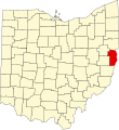
Size of this PNG preview of this SVG file: 552 × 600 pixels. Other resolutions: 221 × 240 pixels | 442 × 480 pixels | 707 × 768 pixels | 942 × 1,024 pixels | 1,885 × 2,048 pixels | 1,050 × 1,141 pixels.
Original file (SVG file, nominally 1,050 × 1,141 pixels, file size: 37 KB)
File history
Click on a date/time to view the file as it appeared at that time.
| Date/Time | Thumbnail | Dimensions | User | Comment | |
|---|---|---|---|---|---|
| current | 01:37, 25 June 2024 |  | 1,050 × 1,141 (37 KB) | Nux | fix rendering (remove clipping) |
| 16:08, 12 February 2006 |  | 3,675 × 3,995 (58 KB) | David Benbennick | {{subst:User:Dbenbenn/clm|county=Jefferson County|state=Ohio|type=county}} |
File usage
The following 95 pages use this file:
- Adena, Ohio
- Alikanna, Ohio
- Altamont, Ohio
- Amsterdam, Ohio
- Annapolis, Ohio
- Belvedere, Ohio
- Bergholz, Ohio
- Bloomingdale, Ohio
- Bradley, Ohio
- Brilliant, Ohio
- Broadacre, Ohio
- Brush Creek Township, Jefferson County, Ohio
- Calumet, Ohio
- Chandler, Ohio
- Circle Green, Ohio
- Connorville, Ohio
- Costonia, Ohio
- Cream City, Ohio
- Cross Creek Township, Ohio
- Deandale, Ohio
- Deyarmonville, Ohio
- Dillonvale, Jefferson County, Ohio
- Dunglen, Ohio
- East Springfield, Ohio
- Emerson, Ohio
- Empire, Ohio
- Fairplay, Ohio
- Fernwood, Ohio
- Georges Run, Ohio
- Gould, Ohio
- Grandview Heights, Jefferson County, Ohio
- Greentown, Jefferson County, Ohio
- Hammondsville, Ohio
- Herrick, Ohio
- Holt, Ohio
- Hopewell, Jefferson County, Ohio
- Irondale, Ohio
- Island Creek Township, Jefferson County, Ohio
- Jackson Heights, Jefferson County, Ohio
- Jefferson County, Ohio
- Knox Township, Jefferson County, Ohio
- Knoxville, Ohio
- List of counties in Ohio
- McConnelsville, Jefferson County, Ohio
- McIntyre, Ohio
- Middleburg, Jefferson County, Ohio
- Mingo Junction, Ohio
- Monroeville, Jefferson County, Ohio
- Mount Pleasant, Ohio
- Mount Pleasant Township, Jefferson County, Ohio
- National Register of Historic Places listings in Jefferson County, Ohio
- New Alexandria, Ohio
- New Somerset, Ohio
- Newell, Ohio
- Olszeski Town, Ohio
- Osage, Ohio
- Panhandle, Ohio
- Parlett, Ohio
- Piney Fork, Ohio
- Port Homer, Ohio
- Pottery Addition, Ohio
- Pravo, Ohio
- Ramsey, Ohio
- Rayland, Ohio
- Reeds Mill, Ohio
- Richmond, Ohio
- Robyville, Ohio
- Ross Township, Jefferson County, Ohio
- Rush Run, Ohio
- Salem Township, Jefferson County, Ohio
- Saline Township, Jefferson County, Ohio
- Shady Glen, Ohio
- Smithfield, Ohio
- Smithfield Township, Jefferson County, Ohio
- Springfield Township, Jefferson County, Ohio
- Steubenville, Ohio
- Steubenville Township, Jefferson County, Ohio
- Stratton, Ohio
- Tiltonsville, Ohio
- Toronto, Ohio
- Unionport, Ohio
- Warren Township, Jefferson County, Ohio
- Warrenton, Ohio
- Wayne Township, Jefferson County, Ohio
- Weems, Ohio
- Wells Township, Jefferson County, Ohio
- Wintersville, Ohio
- Wolf Run, Ohio
- Yellow Creek, Ohio
- York, Jefferson County, Ohio
- Yorkville, Ohio
- User:Nyttend/County templates/OH/1
- Wikipedia:WikiProject Ohio/County Templates
- Template:Jefferson County, Ohio
- Category:Populated places in Jefferson County, Ohio
Global file usage
The following other wikis use this file:
- Usage on ar.wikipedia.org
- Usage on azb.wikipedia.org
- Usage on bg.wikipedia.org
- Usage on bpy.wikipedia.org
- Usage on ca.wikipedia.org
- Usage on cdo.wikipedia.org
- Usage on ceb.wikipedia.org
- Usage on cy.wikipedia.org
- Usage on da.wikipedia.org
- Usage on de.wikipedia.org
- Usage on el.wikipedia.org
- Usage on eo.wikipedia.org
- Usage on es.wikipedia.org
- Usage on et.wikipedia.org
- Usage on eu.wikipedia.org
- Usage on fa.wikipedia.org
View more global usage of this file.