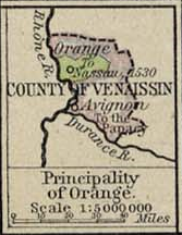
Oranje1547.png (167 × 216 pixels, file size: 61 KB, MIME type: image/png)
File history
Click on a date/time to view the file as it appeared at that time.
| Date/Time | Thumbnail | Dimensions | User | Comment | |
|---|---|---|---|---|---|
| current | 21:57, 26 September 2007 |  | 167 × 216 (61 KB) | Ale flashero | Oranje 1547.png Deze afbeelding is afkomstig uit de kaartencollectie van de University of Texas (http://www.lib.utexas.edu/maps/). Deze kaarten bevinden zich in het publiek domein (http://www.lib.utexas.edu/maps/faq.html#3.html). [http://nl.wikipedia.org/ |
File usage
The following 5 pages use this file:
Global file usage
The following other wikis use this file:
- Usage on de.wikipedia.org
- Usage on es.wikipedia.org
- Usage on et.wikipedia.org
- Usage on fr.wikipedia.org
- Usage on fy.wikipedia.org
- Usage on he.wikipedia.org
- Usage on it.wikipedia.org
- Usage on nl.wikipedia.org
- Usage on pt.wikipedia.org
- Usage on ro.wikipedia.org
- Usage on sl.wikipedia.org
- Usage on uk.wikipedia.org
