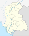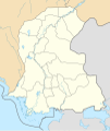
Size of this PNG preview of this SVG file: 499 × 599 pixels. Other resolutions: 200 × 240 pixels | 400 × 480 pixels | 640 × 768 pixels | 853 × 1,024 pixels | 1,706 × 2,048 pixels | 858 × 1,030 pixels.
Original file (SVG file, nominally 858 × 1,030 pixels, file size: 585 KB)
File history
Click on a date/time to view the file as it appeared at that time.
| Date/Time | Thumbnail | Dimensions | User | Comment | |
|---|---|---|---|---|---|
| current | 16:30, 8 September 2021 |  | 858 × 1,030 (585 KB) | C1MM | Added Karachi districts |
| 05:46, 6 September 2021 |  | 858 × 1,030 (584 KB) | C1MM | Added better boundaries and rivers | |
| 21:59, 18 April 2020 |  | 1,000 × 1,200 (610 KB) | C1MM | Standardized colors and added borders | |
| 14:25, 8 May 2019 |  | 1,080 × 1,280 (300 KB) | Kaleem Bhatti | ||
| 14:16, 8 May 2019 |  | 1,080 × 1,280 (301 KB) | Kaleem Bhatti | Outline fixed | |
| 16:13, 7 May 2019 |  | 1,080 × 1,280 (300 KB) | Kaleem Bhatti | User created page with UploadWizard |
File usage
More than 100 pages use this file. The following list shows the first 100 pages that use this file only. A full list is available.
- Badin
- Begum Nusrat Bhutto International Airport
- Chambar
- Chelhar
- Churna Island
- Dadu, Sindh
- Daharki
- Dhoraji Colony
- Diplo Tehsil
- Dokri
- Dokri Tehsil
- Gambat
- Gharo
- Ghogharo
- Ghotki
- Hala, Sindh
- Hawke's Bay Beach
- Hirabad, Hyderabad
- Husri
- Hyderabad, Pakistan
- Jacobabad
- Jacobabad Junction railway station
- Jamshoro
- Karoonjhar Mountains
- Kashmir Goth
- Kashmore
- Kazi Ahmed Taluka
- Keamari (locality)
- Khairpur
- Khangarh, Sindh
- Khipro Tehsil
- Khudabad
- Kot Diji
- Kot Diji Fort
- Kot Ghulam Muhammad Tehsil
- Kotri
- Larkana
- Manjhu
- Manora, Karachi
- Mansura, Sindh
- Matiari
- Matli
- Mehrabpur
- Miani, Sindh
- Miranpur, Sindh
- Mirpur Bathoro Tehsil
- Mirpur Khas
- Mirpur Mathelo
- Mithi
- Mithiani
- Moenjo Daro Airport
- Moro, Pakistan
- Naserpur
- Naushahro Feroze
- Nawabshah
- Nindo Shaher
- Oyster Rocks, Karachi
- PAF Base Shahbaz
- Pano Akil
- Qadirpur gas field
- Raharki
- Ranikot Fort
- Ranipur, Sindh
- Ratodero
- Ratodero Tehsil
- Rohri
- Sadh Belo
- Sakrand Taluka
- Samaro
- Sandspit Beach
- Sanghar
- Sehwan
- Sekhat
- Shah Faisal Colony
- Shahdadpur
- Shikarpur, Sindh
- Shri Varun Dev Mandir
- Sinjoro
- Sobho Dero
- Sujawal
- Sukkur
- Tando Adam Khan
- Tando Allahyar
- Tando Jam
- Tando Muhammad Khan
- Tangwani
- Thatta
- Therhi
- Tombs of the Talpur Mirs
- Umarkot Shiv Mandir
- Umerkot
- User:Adnann
- User:Jamoot
- User:Nisaar
- User:Sindhii
- User:Sindhuu
- User:Sommoro
- User:Taar~enwiki
- User talk:Zuhaibbhatti
- Wikipedia:Userboxes/Location/Pakistan
View more links to this file.
Global file usage
The following other wikis use this file:
- Usage on as.wikipedia.org
- Usage on bn.wikipedia.org
- করাচি
- টেমপ্লেট:অবস্থান মানচিত্র পাকিস্তান সিন্ধু
- থাট্টা
- ২০১৭ লাল শাহবাজ কালান্দারের মাজারে বোমা হামলা
- বাদিন
- হায়দ্রাবাদ, সিন্ধু
- জেকোবাবাদ
- খৈরপুর
- নওয়াবশাহ
- সুক্কুর
- বানভোর বিভাগ
- খায়েরপুর জেলা
- মডিউল:অবস্থান মানচিত্র/উপাত্ত/পাকিস্তান সিন্ধু
- মডিউল:অবস্থান মানচিত্র/উপাত্ত/পাকিস্তান সিন্ধু/নথি
- স্যান্ডসপিট সৈকত
- চানহুদাড়ো
- চুরিও জাবাল দুর্গা মাতা মন্দির
- উমারকোট শিব মন্দির
- শ্রী রামদেব পীর মন্দির
- দরিয়া লাল মন্দির
- পঞ্চমুখী হনুমান মন্দির
- কালকা গুহা মন্দির
- শ্রী লক্ষ্মী নারায়ণ মন্দির, করাচি
- Usage on de.wikipedia.org
- Usage on eo.wikipedia.org
- Usage on es.wikipedia.org
- Usage on fa.wikipedia.org
View more global usage of this file.