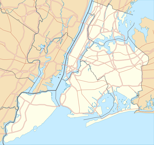
Size of this PNG preview of this SVG file: 634 × 600 pixels. Other resolutions: 254 × 240 pixels | 507 × 480 pixels | 812 × 768 pixels | 1,082 × 1,024 pixels | 2,164 × 2,048 pixels.
Original file (SVG file, nominally 800 × 757 pixels, file size: 418 KB)
File history
Click on a date/time to view the file as it appeared at that time.
| Date/Time | Thumbnail | Dimensions | User | Comment | |
|---|---|---|---|---|---|
| current | 22:57, 2 January 2010 |  | 800 × 757 (418 KB) | Alexrk2 | roads under boundaries |
| 22:54, 2 January 2010 |  | 800 × 757 (418 KB) | Alexrk2 | changed road signature | |
| 13:25, 2 January 2010 |  | 800 × 757 (482 KB) | Alexrk2 | == {{int:filedesc}} == {{Information |Description= {{de|Positionskarte von New York City, USA}} Quadratische Plattkarte, N-S-Streckung 130.0 %. Geographische Begrenzung der Karte: * N: 40.92° N * S: 40.49° N * W: 74.27� |
File usage
More than 100 pages use this file. The following list shows the first 100 pages that use this file only. A full list is available.
- 103rd Street station (IRT Lexington Avenue Line)
- 110th Street station (IRT Lexington Avenue Line)
- 116th Street station (IRT Lexington Avenue Line)
- 125th Street station (IRT Lexington Avenue Line)
- 138th Street–Grand Concourse station
- 163rd Street–Amsterdam Avenue station
- 167th Street station (IRT Jerome Avenue Line)
- 170th Street station (IRT Jerome Avenue Line)
- 176th Street station
- 183rd Street station (IRT Jerome Avenue Line)
- 18th Street station (IRT Lexington Avenue Line)
- 23rd Street station (IRT Lexington Avenue Line)
- 28th Street station (IRT Lexington Avenue Line)
- 68th Street–Hunter College station
- 77th Street station (IRT Lexington Avenue Line)
- 86th Street station (IRT Lexington Avenue Line)
- 96th Street station (IRT Lexington Avenue Line)
- Astor Place station
- Battle of Long Island
- Bedford Park Boulevard–Lehman College station
- Belmont Park
- Bergen Street station (IRT Eastern Parkway Line)
- Bowling Green station
- Brook Avenue station
- Brooklyn
- Buhre Avenue station
- Burnside Avenue station
- CBGB
- Castle Hill Avenue station
- Cathedral of St. John the Divine
- Cemetery of the Evergreens
- Charlie Parker
- City University of New York
- Clay Pit Ponds State Park Preserve
- Cobble Hill Tunnel
- Crown Heights–Utica Avenue station
- Cypress Avenue station
- Dumbo, Brooklyn
- East 143rd Street–St. Mary's Street station
- East 149th Street station
- Eastern Parkway–Brooklyn Museum station
- Ebbets Field
- Elder Avenue station
- Ellis Island
- Erasmus Hall High School
- Flatiron Building
- Fordham Road station (IRT Jerome Avenue Line)
- Fordham University
- Fort Schuyler
- Governors Island National Monument
- Grand Army Plaza
- Grand Army Plaza station
- Greenwich Village
- Hotel Chelsea
- Hunts Point Avenue station
- Jamaica Bay
- Kingsbridge Road station (IRT Jerome Avenue Line)
- Kingston Avenue station
- Liberty Island
- Lincoln Center
- Long Island City
- Long Island Motor Parkway
- Longwood Avenue station
- MTA Bridges and Tunnels
- Madison Square Garden
- Manhattan
- Middletown Road station
- Morrison Avenue–Soundview station
- Mosholu Parkway station
- Mount Eden Avenue station
- Nevins Street station
- New Utrecht Reformed Church
- Nostrand Avenue station (IRT Eastern Parkway Line)
- Old Stone House (Brooklyn)
- Parkchester station
- Pelham Bay Park station
- Queens
- Queens–Midtown Tunnel
- Rikers Island
- Saint Thomas Church (Manhattan)
- Shea Stadium
- SoHo, Manhattan
- Socrates Sculpture Park
- South Street Seaport
- Spring Street station (IRT Lexington Avenue Line)
- St. Lawrence Avenue station
- Staten Island
- Sutter Avenue–Rutland Road station
- The Bronx
- The Cloisters
- Todt Hill
- USS Intrepid (CV-11)
- Union Theological Seminary
- Unisphere
- Wall Street station (IRT Lexington Avenue Line)
- Westchester Square–East Tremont Avenue station
- Whitlock Avenue station
- Woodlawn Cemetery (Bronx, New York)
- Woodlawn station (IRT Jerome Avenue Line)
- Woolworth Building
View more links to this file.
Global file usage
The following other wikis use this file:
- Usage on als.wikipedia.org
- Usage on ar.wikipedia.org
- Usage on arz.wikipedia.org
- Usage on ast.wikipedia.org
- Usage on az.wikipedia.org
- Usage on ban.wikipedia.org
- Usage on ba.wikipedia.org
- Usage on be.wikipedia.org
- Usage on bg.wikipedia.org
- Usage on bh.wikipedia.org
- Usage on bn.wikipedia.org
- টেমপ্লেট:তথ্যছক ঐতিহাসিক স্থান
- টেমপ্লেট:অবস্থান মানচিত্র মার্কিন যুক্তরাষ্ট্র নিউ ইয়র্ক সিটি
- অ্যাস্টোরিয়া, কুইন্স
- মেট্রোপলিটন মিউজিয়াম অব আর্ট
- ক্রাইসলার বিল্ডিং
- উলঅর্থ বিল্ডিং
- টেমপ্লেট:তথ্যছক ঐতিহাসিক স্থান/নথি
- মডিউল:অবস্থান মানচিত্র/উপাত্ত/মার্কিন যুক্তরাষ্ট্র নিউ ইয়র্ক শহর
- মডিউল:অবস্থান মানচিত্র/উপাত্ত/মার্কিন যুক্তরাষ্ট্র নিউ ইয়র্ক শহর/নথি
- ৮৬তম স্ট্রিট স্টেশন (সেকেন্ড অ্যাভিনিউ সাবওয়ে)
- ৯৬তম স্ট্রিট স্টেশন (সেকেন্ড অ্যাভিনিউ সাবওয়ে)
- লাগুয়ার্ডিয়া বিমানবন্দর
- ৫৭তম স্ট্রিট স্টেশন (আইএনডি সিক্সথ অ্যাভিনিউ লাইন)
- রুজভেল্ট আইল্যান্ড স্টেশন
- হিন্দু টেম্পল সোসাইটি অফ নর্থ আমেরিকা
- ৮৬তম স্ট্রিট স্টেশন (বিএমটি ফোর্থ অ্যাভিনিউ লাইন)
View more global usage of this file.

