Size of this PNG preview of this SVG file: 721 × 600 pixels. Other resolutions: 289 × 240 pixels | 577 × 480 pixels | 923 × 768 pixels | 1,231 × 1,024 pixels | 2,462 × 2,048 pixels | 1,500 × 1,248 pixels.
Original file (SVG file, nominally 1,500 × 1,248 pixels, file size: 4.33 MB)
File history
Click on a date/time to view the file as it appeared at that time.
| Date/Time | Thumbnail | Dimensions | User | Comment | |
|---|---|---|---|---|---|
| current | 14:53, 4 February 2022 |  | 1,500 × 1,248 (4.33 MB) | Ikonact | desc // Editing SVG source code using c:User:Rillke/SVGedit.js |
| 14:52, 4 February 2022 |  | 1,500 × 1,248 (4.33 MB) | Ikonact | desc & title modification // Editing SVG source code using c:User:Rillke/SVGedit.js | |
| 14:50, 4 February 2022 |  | 1,500 × 1,248 (4.33 MB) | Ikonact | +desc // Editing SVG source code using c:User:Rillke/SVGedit.js | |
| 14:47, 4 February 2022 |  | 1,500 × 1,248 (4.33 MB) | Ikonact | + title // Editing SVG source code using c:User:Rillke/SVGedit.js | |
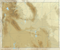
| 08:31, 4 February 2022 |  | 1,500 × 1,248 (4.33 MB) | Ikonact | =={{int:filedesc}}== {{Information |description={{en|1=Relief location map of {{W|Wyoming}}, {{W|USA}} Geographic limits of the map: * N: 45.2° N * S: 40.8° N * W: 111.3° W * E: 103.9° W}} |date=2022-02-04 |source={{own}} *Based on File:USA Wyoming location map.svg *Public domain SRTM3 |author=ikonact |permission= |other versions= }} =={{int:license-header}}== {{self|cc-by-sa-4.0}} Category:Location maps of Wyoming |
File usage
More than 100 pages use this file. The following list shows the first 100 pages that use this file only. A full list is available.
- Arena-Auditorium
- Bamforth National Wildlife Refuge
- Bear River State Park
- Beartooth Highway
- Bighorn National Forest
- Bivouac Peak
- Boysen State Park
- Buck Mountain (Wyoming)
- Buffalo Bill State Park
- Casper, Wyoming
- Central Wyoming Regional Airport
- Cheyenne Regional Airport
- Cloud Peak
- Cloud Peak Glacier
- Cloud Peak Wilderness
- Cloudveil Dome
- Cokeville Meadows National Wildlife Refuge
- Colter's Hell
- Continental Glacier
- Craig Pass
- Curt Gowdy State Park
- Devils Tower
- Disappointment Peak (Wyoming)
- Doane Peak
- Eagles Rest Peak
- Edness K. Wilkins State Park
- Elk Mountain, Wyoming
- Emma Matilda Lake
- Encampment River Wilderness
- Firehole River
- Flaming Gorge National Recreation Area
- Flaming Gorge Reservoir
- Fontenelle Reservoir
- Forellen Peak
- Fort Laramie National Historic Site
- Fossil Butte National Monument
- Fossil Mountain (Wyoming)
- Francs Peak
- Fremont Peak (Wyoming)
- Gannett Glacier
- Gannett Peak
- Gillette–Campbell County Airport
- Grand Targhee Resort
- Grand Teton
- Grand Teton National Park
- Gray Peak (Wyoming)
- Gros Ventre Wilderness
- Heart Mountain (Wyoming)
- Hot Springs State Park
- Hutton Lake National Wildlife Refuge
- Jackson Hole Mountain Resort
- Jackson Lake (Wyoming)
- Jenny Lake
- John D. Rockefeller Jr. Memorial Parkway
- Keyhole State Park
- Lake Alice (Wyoming)
- Laramie Regional Airport
- Leigh Lake
- List of Wyoming state parks
- Medicine Bow Mountains
- Middle Teton
- Mount Moran
- Mount Saint John
- Mount Washburn
- Mount Woodring
- National Elk Refuge
- Nez Perce Peak
- Pathfinder National Wildlife Refuge
- Pathfinder Reservoir
- Platte River Wilderness
- Ranger Peak (Wyoming)
- Rawlins, Wyoming
- Raynolds Peak
- Rendezvous Mountain
- Rockchuck Peak
- Rolling Thunder Mountain
- Savage Run Wilderness
- Schoolroom Glacier
- Seedskadee National Wildlife Refuge
- Sheridan County Airport
- Shoshone National Forest
- Signal Mountain (Wyoming)
- Sinks Canyon State Park
- South Teton
- Southwest Wyoming Regional Airport
- Symmetry Spire
- Teepe Pillar
- Teewinot Mountain
- Teton Pass
- Thor Peak (Wyoming)
- Togwotee Pass
- Traverse Peak
- Two Ocean Lake
- Upper Fremont Glacier
- War Memorial Stadium (Laramie, Wyoming)
- Wheatland Reservoir
- Wind River Peak
- Worland Municipal Airport
- Wrangler Lake
- Yellowstone Lake
View more links to this file.
Global file usage
The following other wikis use this file:
- Usage on de.wikipedia.org
- Grand Canyon of the Yellowstone
- Upper Falls
- Lower Falls
- Hayden Valley
- Mount Washburn
- Crystal Falls
- Eagle Peak (Park County)
- Oberes Geysir-Becken
- Jackson Hole
- Gibbon-Fälle
- Jackson Lake
- Jenny Lake
- Vorlage:Positionskarte USA Wyoming
- Lewis Lake
- Buffalo Bill Dam
- Shoshone Lake
- Lake DeSmet
- Bear River State Park
- Mount Moran
- Boysen State Park
- Hot Springs State Park
- Glendo State Park
- Laramie Peak
- Heart Lake (Wyoming)
- Sinks Canyon State Park
- Buffalo Bill State Park
- Curt Gowdy State Park
- Gannett Peak
- Edness K. Wilkins State Park
- Wyoming Hereford Ranch Reservoir Number 1
- Wyoming Hereford Ranch Reservoir Number 2
- Packer Lake (Wyoming)
- Cirque of the Towers
- Mount Sheridan
- KKPL
- Hawk Springs State Recreation Area
- Keyhole State Park
- Seminoe State Park
- Mount Everts
- Two Ocean Lake
- Grand Teton
- Cedar Mountain (Wyoming)
- Mount Schurz
- Lamar Valley
- KWRR
- KUWA
- Breccia Peak (Wyoming)
- Buck Mountain (Wyoming)
- Union Peak (Wyoming)
- Whiskey Mountain
View more global usage of this file.