Al-Khunayzir (Arabic: الخنيزر), was a Palestinian Arab village in the District of Baysan. It was depopulated during the 1948 Arab-Israeli War on May 20, 1948.
Al-Khunayzir
الخنيزر 'Arab al Khuneizir[1] | |
|---|---|
Village | |
| Etymology: Tell el Khaneizîr, the mound of the swine[2] | |
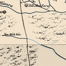
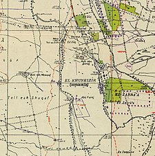
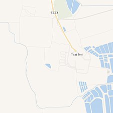
A series of historical maps of the area around Al-Khunayzir (click the buttons) | |
Location within Mandatory Palestine | |
| Coordinates: 32°25′17″N 35°31′20″E / 32.42139°N 35.52222°E | |
| Palestine grid | 199/203 |
| Geopolitical entity | Mandatory Palestine |
| Subdistrict | Baysan |
| Date of depopulation | May 20, 1948[1] |
| Area | |
• Total | 3,107 dunams (3.107 km2 or 1.200 sq mi) |
| Population (1945) | |
• Total | 260[3][4] |
| Cause(s) of depopulation | Influence of nearby town's fall[1] |
| Current Localities | Tirat Zvi[5] |
History
editIn 1881, a nearby tell was named as Tell el Khaneizîr, meaning the mound of the swine, and a nearby spring was named as Ain el Khaneizîr meaning the spring of the swine.[6] خنزير means pig in Arabic.[2]
British Mandate era
editIn the 1922 census of Palestine, conducted by the Mandatory Palestine authorities, Kunaizir had a population of 83; all Muslims,[7] increasing in the 1931 census to 200 Muslims, in a total of 47 houses.[8]
In the 1945 statistics the population was 260 Muslims,[3] with a total of 3,107 dunams of land.[4] Of this, 36 dunams were for citrus and bananas, 1,658 for plantations and irrigated land, 256 for cereals,[9] while 34 dunams were non-cultivable land.[10]
1948, and aftermath
editAccording to B. Morris, 'Arab al Khuneizir was abandoned by its population under the "[i]nfluence of nearby town's fall", on 20 May 1948.[1]
In 1992 it was described: "The only remaining landmarks is a cemetery on Tall Abu al-Faraj (199/203), north of the site. To the north and the west of this tell are the springs of 'Uyun Umm al-Faraj and 'Ayn al-Khanazir. Most of the village site and the land around it are covered with palm trees."[5]
References
edit- ^ a b c d Morris, 2004, p. xvii, village #131. Also gives cause of depopulation
- ^ a b Palmer, 1881, p. 169
- ^ a b Government of Palestine, Department of Statistics, 1945, p. 6
- ^ a b c Government of Palestine, Department of Statistics. Village Statistics, April, 1945. Quoted in Hadawi, 1970, p. 43
- ^ a b Khalidi, 1992, p. 54
- ^ Palmer p.157
- ^ Barron, 1923, Table IX, p. 31
- ^ Mills, 1932, p. 79
- ^ Government of Palestine, Department of Statistics. Village Statistics, April, 1945. Quoted in Hadawi, 1970, p. 85
- ^ Government of Palestine, Department of Statistics. Village Statistics, April, 1945. Quoted in Hadawi, 1970, p. 135
Bibliography
edit- Barron, J.B., ed. (1923). Palestine: Report and General Abstracts of the Census of 1922. Government of Palestine.
- Government of Palestine, Department of Statistics (1945). Village Statistics, April, 1945.
- Hadawi, S. (1970). Village Statistics of 1945: A Classification of Land and Area ownership in Palestine. Palestine Liberation Organization Research Center. Archived from the original on 2018-12-08. Retrieved 2009-08-18.
- Khalidi, W. (1992). All That Remains:The Palestinian Villages Occupied and Depopulated by Israel in 1948. Washington D.C.: Institute for Palestine Studies. ISBN 0-88728-224-5.
- Mills, E., ed. (1932). Census of Palestine 1931. Population of Villages, Towns and Administrative Areas. Jerusalem: Government of Palestine.
- Morris, B. (2004). The Birth of the Palestinian Refugee Problem Revisited. Cambridge University Press. ISBN 978-0-521-00967-6.
- Palmer, E.H. (1881). The Survey of Western Palestine: Arabic and English Name Lists Collected During the Survey by Lieutenants Conder and Kitchener, R. E. Transliterated and Explained by E.H. Palmer. Committee of the Palestine Exploration Fund.
External links
edit- Welcome To al-Khunayzir
- al-Khunayzir, Zochrot
- Survey of Western Palestine, Map 9: IAA, Wikimedia commons


