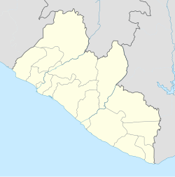
New Kru Town is a northwestern coastal suburb of Monrovia, Liberia.
New Kru Town | |
|---|---|
Borough | |
| Coordinates: 6°22′24″N 10°47′34″W / 6.37333°N 10.79278°W | |
| Country | |
| County | Montserrado County |
| District | Greater Monrovia |
| Government | |
| • Governor | Tarpeh D. Carter |
| Area | |
• Total | 5.13 km2 (1.98 sq mi) |
| Population (2014[2]) | |
• Total | 84,399 |
| • Density | 16,000/km2 (43,000/sq mi) |
| Time zone | UTC+0 (GMT) |
Overview
editNew Kru Town is a northwestern coastal suburb of Monrovia, located on the north end of Bushrod Island. It is the only borough in Liberia.[3]
The town grew as a planned "transplant" town of Old Kru Town after World War II when "Old Kru Town was evacuated for the development of a new breakwater for the new port with assistance from the Liberian government".[4] Being located where the Saint Paul River estuary meets the Atlantic Ocean, sea-fishing is an important source of income.[5]
A slum area, it has been subject to ethnic tensions.[6] Squatted houses are built in precarious zones and in 2013, 200 homes were washed away by a high tide.[7] In 2019 President George Weah appointed Tarpeh D. Carter as governor of New Kru Town, replacing Alice Weah.[8] New Kru Town constitutes the Montserrado-16 electoral district.[2]
Landmarks
editAn "imposing" church was built in New Kru Town in about 1975 by American missionaries.[9] It also contains the Redemption Hospital and the multi-million dollar D. Tweh Memorial High School, "originally named in honor of Tolbert before the 1980 coup".[10] An avenue, Botoe Avenue, is named after Thomas Nimene Botoe.
Demographics
editNew Kru Town (or Zone Z100) is divided into 14 communities;
| Community | Inhabitants (2014 est.) | No. of households (2014 est.) |
|---|---|---|
| Bong Mines Bridge | 5,573 | 1,359 |
| Central New Kru Town | 5,880 | 1,434 |
| Crab Hole | 7,532 | 1,837 |
| Duala Market | 6,405 | 1,562 |
| Duala Mombo Town-East | 8,752 | 2,135 |
| Fundaye | 4,259 | 1,039 |
| Lagoon East | 5,405 | 1,318 |
| Lagoon West | 5,575 | 1,360 |
| Monboe Town West | 3,475 | 848 |
| Nyuan Town | 6,692 | 1,632 |
| Point Four | 7,317 | 1,785 |
| Popo Beach A | 5,938 | 1,448 |
| Popo Beach B | 2,913 | 710 |
| Tweh Farm | 8,683 | 2,118 |
| Total: | 84,399 | 20,585 |
References
edit- ^ JICA. THE MASTER PLAN STUDY ON URBAN FACILITIES RESTORATION AND IMPROVEMENT IN MONROVIA IN THE REPUBLIC OF LIBERIA
- ^ a b c National Electoral Commission. "Montserrado County Electoral District No.16 2017"
- ^ "Liberia Housing Profile" (PDF). United Nations Human Settlements Programme. 2014. p. 15. Archived from the original (PDF) on 17 October 2017. Retrieved 16 October 2017.
- ^ Sawyer, Amos (1992). The emergence of autocracy in Liberia: tragedy and challenge. Institute for Contemporary Studies. ISBN 978-1-55815-164-2. Retrieved 28 April 2012.
- Obudho, Robert A.; Mhlanga, Constance C. (1988). Slum and squatter settlements in Sub-Saharan Africa: toward a planning strategy. Praeger. ISBN 978-0-275-92309-9. Retrieved 28 April 2012. - ^ United States. Foreign Broadcast Information Service (1982). Sub-Saharan Africa report. Foreign Broadcast Information Service. pp. 59–60. Retrieved 28 April 2012.
- ^ Dolo, Emmanuel (31 October 2007). Ethnic Tensions in Liberia's National Identity Crisis: Problems and Possibilities. Africana Homestead Legacy Pb. p. 64. ISBN 978-0-9770904-1-9. Retrieved 28 April 2012.
- ^ Tipple, Graham (2014). Liberia: Housing profile (PDF). Nairobi, Kenya: UN-HABITAT. ISBN 978-92-1-132626-0.
- ^ Executive Mansion. "New Kru Town Gets New Governor"
- ^ Gifford, Paul (16 May 2002). Christianity and Politics in Doe's Liberia. Cambridge University Press. p. 206. ISBN 978-0-521-52010-2. Retrieved 28 April 2012.
- ^ Maps (Map). Google Maps.
- Sherman, Frank (31 January 2010). Liberia: The Land, Its People, History and Culture. Godfrey Mwakikagile. p. 52. ISBN 978-9987-16-025-9. Retrieved 28 April 2012. - ^ Liberia Institute of Statistics and Geo-Information Services. "Population 2008, 2014 by County, District, Clan and Households, Liberia" Archived 2020-07-13 at the Wayback Machine
