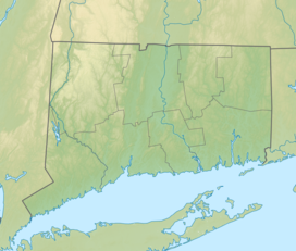
Pomeroy State Park is an undeveloped public recreation area covering 200 acres (81 ha) just south of Willimantic in the town of Lebanon, Connecticut, managed by the Connecticut Department of Energy and Environmental Protection.[2] The state park is a forested area used for hiking and hunting with no formal entrance, markings, or parking that abuts preserved farmland.[3][4]
| Pomeroy State Park | |
|---|---|
| Location | Lebanon, Connecticut, United States |
| Coordinates | 41°41′57″N 72°13′27″W / 41.69917°N 72.22417°W[1] |
| Area | 200 acres (81 ha)[2] |
| Elevation | 499 ft (152 m)[1] |
| Established | 1953 |
| Administered by | Connecticut Department of Energy and Environmental Protection |
| Designation | Connecticut state park |
| Website | Official website |
History
editThe park was established on the former 90-acre estate of textile manufacturer Charles Pomeroy for whom it is named.[4] The park entered the rolls of the Connecticut State Register and Manual in 1953,[5] when it was listed at 84 acres, that figure expanding to 104 acres ten years later.[6] The state added 91 acres through two separate purchases in 2001[7] and another 2.3 acres in 2007.[8]
Terrain
editThe park preserves a forested area without formal entrance that shares a boundary with preserved farmland.[4] The park is divided by Connecticut Route 289. The park includes the summit of 505-foot (154 m) Bush Hill, south of Hosmer Mountain[9] (492 feet (150 m)). A 2005 property designation map from the Connecticut Department of Environmental Protection uses a portion of the Willimantic quadrangle map to show the hilly terrain on the northeast portion of the park and the top of Bush Hill to the northwest. The southern limits of the park are also hilly with a steeper elevation change at the edge of the southwest boundary.
Activities
editHikers can ascend to the top of Bush Hill.[10] In the fall, the park is open to archers hunting deer and turkey.[11] The park can be accessed by parking along the side of Route 289 (Beaumont Highway).[3]
References
edit- ^ a b "Bush Hill". Geographic Names Information System. United States Geological Survey, United States Department of the Interior.
- ^ a b "Other State Parks and Forests". Connecticut Department of Energy and Environmental Protection. Retrieved July 30, 2024.
- ^ a b "Open Spaces and Trails" (PDF). Town of Lebanon. Retrieved July 30, 2024.
- ^ a b c Leary, Joseph (2004). A Shared Landscape: A Guide & History of Connecticut's State Parks & Forests. Hartford, Conn.: Friends of the Connecticut State Parks, Inc. p. 148. ISBN 0974662909. Leary opines that it is unlikely that the park could be developed because parking is limited to the roadside of Connecticut Route 289.
- ^ "State Parks". State Register and Manual 1953. State of Connecticut. 1953. p. 357. Retrieved August 12, 2016.
- ^ "State Parks". State Register and Manual 1963. State of Connecticut. 1963. p. 169. Retrieved August 12, 2016.
- ^ "October 2001 Open Space Report". Connecticut Department of Environmental Protection. Retrieved July 30, 2024.
- ^ "Appendix A: Properties Acquired under the Recreation and Natural Heritage Trust Program: 2007-2015" (PDF). Connecticut Comprehensive Open Space Acquisition Strategy: 2016-2020 Green Plan. Connecticut Department of Environmental Protection. p. 3. Retrieved July 30, 2024.
- ^ "Hosmer Mountain". Geographic Names Information System. United States Geological Survey, United States Department of the Interior.
- ^ "Pomeroy State Park". The Last Green Valley. Archived from the original on August 22, 2016. Retrieved August 12, 2016.
- ^ "Pomeroy State Park Hunting Map" (PDF). State of Connecticut. September 2023. Retrieved July 30, 2024.
External links
edit- Other State Parks and Forests Connecticut Department of Energy and Environmental Protection
- Pomeroy State Park Hunting Map Connecticut Department of Energy and Environmental Protection

