Portal maintenance status: (No date set)
|
The World Portal

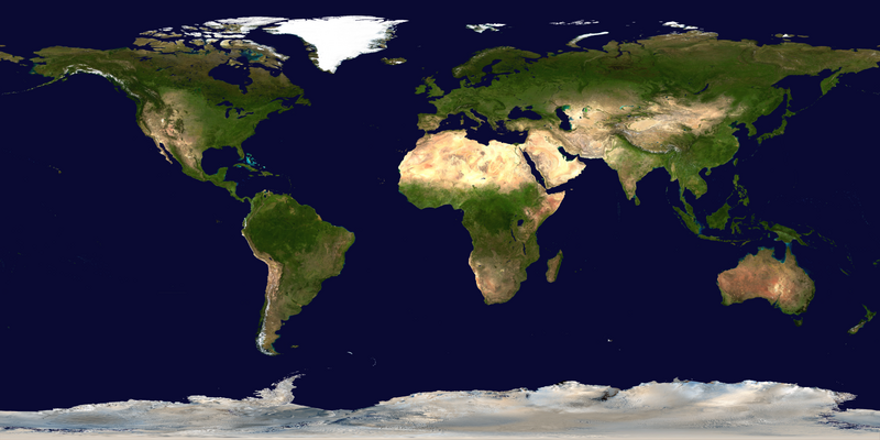
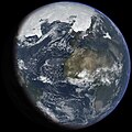
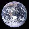
The world is the totality of entities, the whole of reality, or everything that exists. The nature of the world has been conceptualized differently in different fields. Some conceptions see the world as unique, while others talk of a "plurality of worlds". Some treat the world as one simple object, while others analyze the world as a complex made up of parts.
In scientific cosmology, the world or universe is commonly defined as "the totality of all space and time; all that is, has been, and will be". Theories of modality talk of possible worlds as complete and consistent ways how things could have been. Phenomenology, starting from the horizon of co-given objects present in the periphery of every experience, defines the world as the biggest horizon, or the "horizon of all horizons". In philosophy of mind, the world is contrasted with the mind as that which is represented by the mind.
Theology conceptualizes the world in relation to God, for example, as God's creation, as identical to God, or as the two being interdependent. In religions, there is a tendency to downgrade the material or sensory world in favor of a spiritual world to be sought through religious practice. A comprehensive representation of the world and our place in it, as is found in religions, is known as a worldview. Cosmogony is the field that studies the origin or creation of the world, while eschatology refers to the science or doctrine of the last things or of the end of the world.
In various contexts, the term "world" takes a more restricted meaning associated, for example, with the Earth and all life on it, with humanity as a whole, or with an international or intercontinental scope. In this sense, world history refers to the history of humanity as a whole, and world politics is the discipline of political science studying issues that transcend nations and continents. Other examples include terms such as "world religion", "world language", "world government", "world war", "world population", "world economy", or "world championship". (Full article...)
Selected articles - show another
-
Image 1
The World as Will and Representation (WWR; German: Die Welt als Wille und Vorstellung, WWV), sometimes translated as The World as Will and Idea, is the central work of the German philosopher Arthur Schopenhauer. The first edition was published in late 1818, with the date 1819 on the title page. A second, two-volume edition appeared in 1844: volume one was an edited version of the 1818 edition, while volume two consisted of commentary on the ideas expounded in volume one. A third expanded edition was published in 1859, the year before Schopenhauer's death. In 1948, an abridged version was edited by Thomas Mann.
In the summer of 1813, Schopenhauer submitted his doctoral dissertation—On the Fourfold Root of the Principle of Sufficient Reason—and was awarded a doctorate from the University of Jena. After spending the following winter in Weimar, he lived in Dresden and published his treatise On Vision and Colours in 1816. Schopenhauer spent the next several years working on his chief work, The World as Will and Representation. Schopenhauer asserted that the work is meant to convey a "single thought" from various perspectives. He develops his philosophy over four books covering epistemology, ontology, aesthetics, and ethics. Following these books is an appendix containing Schopenhauer's detailed Criticism of the Kantian Philosophy. (Full article...) -
Image 2
The Global Positioning System (GPS), originally Navstar GPS, is a satellite-based radio navigation system owned by the United States Space Force and operated by Mission Delta 31. It is one of the global navigation satellite systems (GNSS) that provide geolocation and time information to a GPS receiver anywhere on or near the Earth where there is an unobstructed line of sight to four or more GPS satellites. It does not require the user to transmit any data, and operates independently of any telephone or Internet reception, though these technologies can enhance the usefulness of the GPS positioning information. It provides critical positioning capabilities to military, civil, and commercial users around the world. Although the United States government created, controls, and maintains the GPS system, it is freely accessible to anyone with a GPS receiver. (Full article...) -
Image 3A world-system is a socioeconomic system, under systems theory, that encompasses part or all of the globe, detailing the aggregate structural result of the sum of the interactions between polities. World-systems are usually larger than single states, but do not have to be global. The Westphalian System is the preeminent world-system operating in the contemporary world, denoting the system of sovereign states and nation-states produced by the Westphalian Treaties in 1648. Several world-systems can coexist, provided that they have little or no interaction with one another. Where such interactions becomes significant, separate world-systems merge into a new, larger world-system. Through the process of globalization, the modern world has reached the state of one dominant world-system, but in human history there have been periods where separate world-systems existed simultaneously, according to Janet Abu-Lughod. The most well-known version of the world-system approach has been developed by Immanuel Wallerstein. A world-system is a crucial element of the world-system theory, a multidisciplinary, macro-scale approach to world history and social change. (Full article...)
-
Image 4"World music" is an English phrase for styles of music from non-English speaking countries, including quasi-traditional, intercultural, and traditional music. World music's broad nature and elasticity as a musical category pose obstacles to a universal definition, but its ethic of interest in the culturally exotic is encapsulated in Roots magazine's description of the genre as "local music from out there".
Music that does not follow "North American or British pop and folk traditions" was given the term "world music" by music industries in Europe and North America. The term was popularized in the 1980s as a marketing category for non-Western traditional music. It has grown to include subgenres such as ethnic fusion (Clannad, Ry Cooder, Enya, etc.) and worldbeat. (Full article...) -
Image 5Global village describes the phenomenon of the entire world becoming more interconnected as the result of the propagation of media technologies throughout the world. The term was coined by Canadian media theorist Marshall McLuhan in his books The Gutenberg Galaxy: The Making of Typographic Man (1962) and Understanding Media (1964). Literary scholar Sue-Im Lee describes how the term global village has come to designate “the dominant term for expressing a global coexistence altered by transnational commerce, migration, and culture” (as cited in Poll, 2012). Economic journalist Thomas Friedman's definition of the global village as a world “tied together into a single globalized marketplace and village” is another contemporary understanding of the term (as cited in Poll, 2012). (Full article...)
-
Image 6

Laws concerning gender identity-expression by country or territory Legal identity change, surgery requiredNo legal identity changeUnknown/Ambiguous
Rights affecting lesbian, gay, bisexual, transgender and queer (LGBTQ) people vary greatly by country or jurisdiction—encompassing everything from the legal recognition of same-sex marriage to the death penalty for homosexuality.
Notably, as of May 2024[update], 37 countries recognize same-sex marriage. By contrast, not counting non-state actors and extrajudicial killings, only two countries are believed to impose the death penalty on consensual same-sex sexual acts: Iran and Afghanistan. The death penalty is officially law, but generally not practiced, in Mauritania, Saudi Arabia, Somalia (in the autonomous state of Jubaland) and the United Arab Emirates. LGBT people also face extrajudicial killings in the Russian region of Chechnya. Sudan rescinded its unenforced death penalty for anal sex (hetero- or homosexual) in 2020. Fifteen countries have stoning on the books as a penalty for adultery, which (in light of the illegality of gay marriage in those countries) would by default include gay sex, but this is enforced by the legal authorities in Iran and Nigeria (in the northern third of the country). (Full article...) -
Image 7

The International Union for Conservation of Nature (IUCN) Red List of Threatened Species, also known as the IUCN Red List or Red Data Book, founded in 1964, is an inventory of the global conservation status and extinction risk of biological species. A series of Regional Red Lists, which assess the risk of extinction to species within a political management unit, are also produced by countries and organizations.
The goals of the Red List are to provide scientifically based information on the status of species and subspecies at a global level, to draw attention to the magnitude and importance of threatened biodiversity, to influence national and international policy and decision-making, and to provide information to guide actions to conserve biological diversity. (Full article...)
General images - load new batch
-
Image 2Peopling of the world, the Southern Dispersal scenario
-
Image 3Battle during the 1281 Mongol invasion of Japan
-
Image 4Tracy Caldwell Dyson, a NASA astronaut, observing Earth from the Cupola module at the International Space Station on 11 September 2010 (from Earth)
-
Image 5Earth's land use for human agriculture in 2019 (from Earth)
-
Image 7A pillar at Göbekli Tepe
-
Image 8Fall of the Berlin Wall, 1989
-
Image 9Tiktaalik, a fish with limb-like fins and a predecessor of tetrapods. Reconstruction from fossils about 375 million years old. (from History of Earth)
-
Image 10A view of Earth with different layers of its atmosphere visible: the troposphere with its clouds casting shadows, a band of stratospheric blue sky at the horizon, and a line of green airglow of the lower thermosphere around an altitude of 100 km, at the edge of space (from Earth)
-
Image 11Trilobites first appeared during the Cambrian period and were among the most widespread and diverse groups of Paleozoic organisms. (from History of Earth)
-
Image 14Last Moon landing: Apollo 17 (1972)
-
Image 15Great Pyramids of Giza, Egypt
-
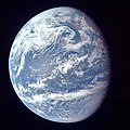
Image 16A view of Earth with its global ocean and cloud cover, which dominate Earth's surface and hydrosphere; at Earth's polar regions, its hydrosphere forms larger areas of ice cover. (from Earth)
-
Image 18Artist's rendition of an oxinated fully-frozen Snowball Earth with no remaining liquid surface water. (from History of Earth)
-
Image 19Lithified stromatolites on the shores of Lake Thetis, Western Australia. Archean stromatolites are the first direct fossil traces of life on Earth. (from History of Earth)
-
Image 21Earth's history with time-spans of the eons to scale. Ma means "million years ago". (from History of Earth)
-
Image 22A banded iron formation from the 3.15 Ga Moodies Group, Barberton Greenstone Belt, South Africa. Red layers represent the times when oxygen was available; gray layers were formed in anoxic circumstances. (from History of Earth)
-
Image 23Artist's impression of Earth during the later Archean, the largely cooled planetary crust and water-rich barren surface, marked by volcanoes and continents, features already round microbialites. The Moon, still orbiting Earth much closer than today and still dominating Earth's sky, produced strong tides. (from History of Earth)
-
Image 24A 2012 artistic impression of the early Solar System's protoplanetary disk from which Earth and other Solar System bodies were formed (from Earth)
-
Image 25Artist's impression of the enormous collision that probably formed the Moon (from History of Earth)
-
Image 26Ajloun Castle, Jordan
-
Image 27Chloroplasts in the cells of a moss (from History of Earth)
-
Image 28Yggdrasil, an attempt to reconstruct the Norse world tree which connects the heavens, the world, and the underworld. (from World)
-
Image 29Pangaea was a supercontinent that existed from about 300 to 180 Ma. The outlines of the modern continents and other landmasses are indicated on this map. (from History of Earth)
-
Image 30Pale orange dot, an artist's impression of Early Earth, featuring its tinted orange methane-rich early atmosphere (from Earth)
-
Image 31Change in average surface air temperature and drivers for that change. Human activity has caused increased temperatures, with natural forces adding some variability. (from Earth)
-
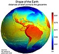
Image 32Earth's western hemisphere showing topography relative to Earth's center instead of to mean sea level, as in common topographic maps (from Earth)
-
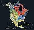
Image 33Geologic map of North America, color-coded by age. From most recent to oldest, age is indicated by yellow, green, blue, and red. The reds and pinks indicate rock from the Archean.
-
Image 34A reconstruction of Pannotia (550 Ma). (from History of Earth)
-
Image 36Vitruvian Man by Leonardo da Vinci epitomizes the advances in art and science seen during the Renaissance. (from History of Earth)
-
Image 38Artist's impression of a Hadean landscape with the relatively newly formed Moon still looming closely over Earth and both bodies sustaining strong volcanism. (from History of Earth)
-
Image 39A composite image of Earth, with its different types of surface discernible: Earth's surface dominating Ocean (blue), Africa with lush (green) to dry (brown) land and Earth's polar ice in the form of Antarctic sea ice (grey) covering the Antarctic or Southern Ocean and the Antarctic ice sheet (white) covering Antarctica. (from Earth)
-
Image 40The replicator in virtually all known life is deoxyribonucleic acid. DNA is far more complex than the original replicator and its replication systems are highly elaborate. (from History of Earth)
-
Image 41Earth's night-side upper atmosphere appearing from the bottom as bands of afterglow illuminating the troposphere in orange with silhouettes of clouds, and the stratosphere in white and blue. Next the mesosphere (pink area) extends to the orange and faintly green line of the lowest airglow, at about one hundred kilometers at the edge of space and the lower edge of the thermosphere (invisible). Continuing with green and red bands of aurorae stretching over several hundred kilometers. (from Earth)
-
Image 45The pale orange dot, an artist's impression of the early Earth which might have appeared orange through its hazy methane rich prebiotic second atmosphere. Earth's atmosphere at this stage was somewhat comparable to today's atmosphere of Titan. (from History of Earth)
-
Image 47Great Mosque of Kairouan, Tunisia, founded 670 CE
-
Image 4913th-century French historiated initial with the three classes of medieval society: those who prayed (the clergy), those who fought (the knights), and those who worked (the peasantry) (from Human history)
-
Image 52Shanghai. China urbanized rapidly in the 21st century.
-
Image 54Cuneiform inscription, eastern Turkey
-
Image 55An artist's impression of ice age Earth at glacial maximum. (from History of Earth)
-
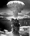
Image 56Atomic bombing of Nagasaki, 1945
-
Image 57A 580 million year old fossil of Spriggina floundensi, an animal from the Ediacaran period. Such life forms could have been ancestors to the many new forms that originated in the Cambrian Explosion. (from History of Earth)
-
Image 59Angkor Wat temple complex, Cambodia, early 12th century
-
Image 60A computer-generated image mapping the prevalence of artificial satellites and space debris around Earth in geosynchronous and low Earth orbit (from Earth)
-
Image 62"Lucy", the first Australopithecus afarensis skeleton found, was only 1.06 m (3 ft 6 in) tall.
-
Image 63Empires of the world in 1898
-
Image 64First airplane, the Wright Flyer, flew on 17 December 1903.
-
Image 66Benin Bronze head from Nigeria
-
Image 67An animation of the changing density of productive vegetation on land (low in brown; heavy in dark green) and phytoplankton at the ocean surface (low in purple; high in yellow) (from Earth)
-
Image 68An artist's impression of the Archean, the eon after Earth's formation, featuring round stromatolites, which are early oxygen-producing forms of life from billions of years ago. After the Late Heavy Bombardment, Earth's crust had cooled, its water-rich barren surface is marked by continents and volcanoes, with the Moon still orbiting Earth half as far as it is today, appearing 2.8 times larger and producing strong tides. (from Earth)
-
Image 73Standing Buddha from Gandhara, 2nd century CE
-
Image 74Obelisk of Axum, Ethiopia
-
Image 75Dinosaurs were the dominant terrestrial vertebrates throughout most of the Mesozoic (from History of Earth)
-
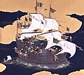
Image 76Japanese depiction of a Portuguese carrack. European maritime innovations led to proto-globalization.
-
Image 77Earth's axial tilt causing different angles of seasonal illumination at different orbital positions around the Sun (from Earth)
-
Image 78A reconstruction of human history based on fossil data. (from History of Earth)
-
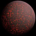
Image 79Artist's conception of Hadean Eon Earth, when it was much hotter and inhospitable to all forms of life. (from History of Earth)
-
Image 80A map of heat flow from Earth's interior to the surface of Earth's crust, mostly along the oceanic ridges (from Earth)
-
Image 81Graph showing range of estimated partial pressure of atmospheric oxygen through geologic time (from History of Earth)
-
Image 82One of the eleven Rock-hewn Churches of Lalibela constructed during the Zagwe dynasty in Ethiopia (from Human history)
-
Image 83Olmec colossal head, now at the Museo de Antropología de Xalapa
-
Image 87Notre-Dame de Paris, France
-
Image 88A schematic view of Earth's magnetosphere with solar wind flowing from left to right (from Earth)
Megacities of the world - show another
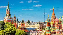
Moscow is the capital and largest city of Russia. The city stands on the Moskva River in Central Russia, with a population estimated at over 13 million residents within the city limits, over 19.1 million residents in the urban area, and over 21.5 million residents in its metropolitan area. The city covers an area of 2,511 square kilometers (970 sq mi), while the urban area covers 5,891 square kilometers (2,275 sq mi), and the metropolitan area covers over 26,000 square kilometers (10,000 sq mi). Moscow is among the world's largest cities, being the most populous city in its entirety in Europe, the largest urban and metropolitan area in Europe, and the largest city by land area on the European continent.
First documented in 1147, Moscow grew to serve as the capital of the Grand Duchy of Moscow. When the Tsardom of Russia was proclaimed, Moscow remained the political and economic center for most of its history. Under the reign of Peter the Great, the Russian capital was moved to the newly founded city of Saint Petersburg in 1712, decreasing Moscow's influence. Following the Russian Revolution and the establishment of the Russian SFSR, the capital was moved back to Moscow in 1918, where it later became the political center of the Soviet Union. In the aftermath of the dissolution of the Soviet Union, Moscow remained the capital city of the newly established Russian Federation. (Full article...)
Did you know - load new batch

- ... that Travis Ludlow broke the world record for the youngest person to fly solo around the world?
- ... that after leaving his job promoting Qatar ahead of the 2022 World Cup, Marc Bennett alleged he was tortured before being found hanged in his hotel room?
- ... that Frederick Perceval, 11th Earl of Egmont, was nicknamed "the loneliest boy in the world" by journalists?
- ... that homes in urban areas must have earthquake insurance before being connected to electricity in Turkey?
- ... that a world record has been set every year Gqeberha has held its Breaking Barriers 50km event?
- ... that Venla Luukkonen is the first Finnish person to win the World IBJJF Jiu-Jitsu Championship at black belt level?
- ... that after the 1931 Hawke's Bay earthquake destroyed Napier Technical College, it was disestablished and amalgamated into its rivals?
- ... that Henry Clay Frick would not take World War I as an excuse for delays in the construction of his New York City house?
Countries of the world - show another

Brazil, officially the Federative Republic of Brazil, is the largest and easternmost country in South America and Latin America. It is the world's fifth-largest country by area and the seventh most populous. Its capital is Brasília, and its most populous city is São Paulo. Brazil is a federation composed of 26 states and a Federal District. It is the only country in the Americas where Portuguese is an official language. Brazil is among the world's most multicultural and ethnically diverse nations, due to over a century of mass immigration from around the world.
Bounded by the Atlantic Ocean on the east, Brazil has a coastline of 7,491 kilometers (4,655 mi). Covering roughly half of South America's land area, it borders all other countries and territories on the continent except Ecuador and Chile. Brazil's Amazon basin includes a vast tropical forest home to diverse wildlife, a variety of ecological systems, and extensive natural resources spanning numerous protected habitats. This unique environmental heritage positions Brazil at number one of 17 megadiverse countries. The country's natural richness is also the subject of significant global interest, as environmental degradation (through processes such as deforestation) has direct impacts on global issues such as climate change and biodiversity loss. (Full article...)

The New 7 Wonders of the World was a campaign started in 2001 to choose Wonders of the World from a selection of 200 existing monuments. The popularity poll via free web-based voting and telephone voting was led by Canadian-Swiss Bernard Weber and organized by the New 7 Wonders Foundation (N7W) based in Zurich, Switzerland, with winners announced on 7 July 2007 at Estádio da Luz in Lisbon. The poll was considered unscientific partly because it was possible for people to cast multiple votes. According to John Zogby, founder and current President/CEO of the Utica, New York–based polling organization Zogby International, New 7 Wonders Foundation drove "the largest poll on record".
The program drew a wide range of official reactions. Some countries touted their finalist and tried to get more votes cast for it, while others downplayed or criticized the contest. After supporting the New 7 Wonders Foundation at the beginning of the campaign by providing advice on nominee selection, the United Nations Educational, Scientific, and Cultural Organization (UNESCO), bound by its bylaws to record and give equal status to all World Heritage Sites, distanced itself from the undertaking in 2001 and again in 2007. (Full article...)
Related portals
Protected areas of the world - load new batch
-
Image 1

Tijuca Forest National Park
Protected areas of Brazil included various classes of area according to the National System of Nature Conservation Units (SNUC), a formal, unified system for federal, state and municipal parks created in 2000. (Full article...) -
Image 2Protected areas of Australia include Commonwealth and off-shore protected areas managed by the Australian government, as well as protected areas within each of the six states of Australia and two self-governing territories, the Australian Capital Territory and the Northern Territory, which are managed by the eight state and territory governments.
Commonwealth and off-shore protected areas in the Australian Capital Territory, the Northern Territory, the Christmas Island Territory, the Cocos (Keeling) Islands Territory, the Norfolk Island Territory and the Australian Antarctic Territory are managed by Director of National Parks, an agency within the Department of Climate Change, Energy, the Environment and Water, with the exception of the Great Barrier Reef Marine Park, which is managed by the Great Barrier Reef Marine Park Authority, a separate body within the department. (Full article...) -
Image 3Papua New Guinea is home to several protected areas, which receive protection because of their environmental, cultural or similar value.
The total area of Papua New Guinea protected territories is 14,330 km2 (5,530 sq mi), which amounts to approximately 3.07% of the country's territory. The total number of protected areas as 2018 is 71. (Full article...) -
Image 4
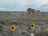
Dinosaur Provincial Park
This is a list of protected areas of Alberta. Protected areas are managed by the Government of Canada or the Government of Alberta. The provincial government owns 60% of Alberta's landmass but most of this has not been formally protected. The total protected area throughout Alberta including federal and provincial protected areas is approximately 90,700 km2 (35,000 sq mi). (Full article...) -
Image 5

Overview of IUCN Protected area - WAP (W, Arli, Pendjari) area - Niger, Burkina Faso, and Benin
The following is a list of protected areas of Burkina Faso. (Full article...) -
Image 6
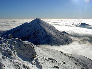
The mountain of Stob Binnein lies in the Loch Lomond and The Trossachs National Park.
Many parts of Scotland are protected in accordance with a number of national and international designations because of their environmental, historical or cultural value. Protected areas can be divided according to the type of resource which each seeks to protect. NatureScot has various roles in the delivery of many environmental designations in Scotland, i.e. those aimed at protecting flora and fauna, scenic qualities and geological features. Historic Environment Scotland is responsible for designations that protect sites of historic and cultural importance. Some international designations, such as World Heritage Sites, can cover both categories of site.
The various designations overlap considerably with many protected areas being covered by multiple designations with different boundaries. (Full article...) -
Image 7There are four categories of protected areas in India, constituted under the Wildlife Protection Act, 1972. Tiger reserves consist of areas under national parks and wildlife sanctuaries. There are 53 tiger reserves in India. As of January 2023,[update] the protected areas of India cover 173,629.52 square kilometres (67,038.73 sq mi), roughly 5.28% of the total geographical area of the country. (Full article...)
-
Image 8This is a list of protected areas of Saudi Arabia, some of which are managed by the Saudi Wildlife Authority.:
- At-Taysiyah Protected Area
- Jabal Shada Nature Reserve
- Majami'al-Hadb Protected Area
- Nafud al-'Urayq
- Raydah Natural Reserve
- 'Uruq Bani Ma'arid
- Saja Umm Ar-Rimth Natural Reserve
- Harrat al-Harrah Protected Area
- Al-Khunfah Natural Reserve
- Ibex Reserve Protected Area
- Mahazat as-Sayd Protected Area
- Umm al-Qamari Islands
- Al-Tubayq Natural Reserve
- Farasan Islands Protected Area
- Jubail Marine Wildlife Sanctuary
- Jabal Aja Protected Area
- Wadi Turabah Nature Reserve
-
Image 9
Cape Spencer Lighthouse, Innes National Park
Protected areas of South Australia, consisting of protected areas located within South Australia and its immediate onshore waters and which are managed by South Australian Government agencies. As of 2018, South Australia contained 359 separate protected areas declared under the National Parks and Wildlife Act 1972, the Crown Land Management Act 2009 and the Wilderness Protection Act 1992. Together, they cover a total land area of 211,387.48 km2 (81,617.16 sq mi) or 21.5% of the state's area. (Full article...) -
Image 10

Kejimkujik National Park, Little River
This is a list of protected areas of Nova Scotia. (Full article...) -
Image 11Protected areas of Tamil Nadu cover an area of 3,305 km2 (1,276 sq mi), constituting 2.54% of the geographic area and 15% of the 22,643 km2 (8,743 sq mi) recorded forest area of the state of Tamil Nadu in South India. It ranks 14th among all the states and union territories of India in terms of total protected area.
Protected areas in South India were created from private hunting grounds of the erstwhile Maharajas of the princely states. Mudumalai National Park was established in 1940 and was the first modern wildlife sanctuary in South India. The protected areas are administered by the Ministry of Environment and Forests of Government of India and the Tamil Nadu Forest Department. (Full article...) -
Image 12

Redwood grove in Redwood National Park
According to the California Protected Areas Database (CPAD), in the state of California, United States, there are over 14,000 inventoried protected areas administered by public agencies and non-profits. In addition, there are private conservation areas and other easements. They include almost one-third of California's scenic coastline, including coastal wetlands, estuaries, beaches, and dune systems. The California State Parks system alone has 270 units and covers 1.3 million acres (5,300 km2), with over 280 miles (450 km) of coastline, 625 miles (1,006 km) of lake and river frontage, nearly 18,000 campsites, and 3,000 miles (5,000 km) of hiking, biking, and equestrian trails.
Obtaining an accurate total of all protected land in California and elsewhere is a complex task. Many parcels have inholdings, private lands within the protected areas, which may or may not be accounted for when calculating total area. Also, occasionally one parcel of land is included in two or more inventories. Over 90% of Yosemite National Park for example, is listed both as wilderness by the National Wilderness Preservation System, and as national park land by the National Park Service. The Cosumnes River Preserve is an extreme example, owned and managed by a handful of public agencies and private landowners, including the Bureau of Land Management, the County of Sacramento and The Nature Conservancy. Despite the difficulties, the CPAD gives the total area of protected land at 49,294,000 acres (199,490 km2), or 47.05% of the state (not including easements); a considerable amount for the most populous state in the country. (Full article...) -
Image 13Queensland is the second-largest state in Australia. As at 2020, it contained more than 1,000 protected areas. In August 2023, it was estimated a total of 14.5 million hectares or 8.38% of Queensland's landmass was protected. (Full article...)
-
Image 14
Mombacho Volcano Natural Reserve
The protected areas of Nicaragua are areas that have natural beauty or significance and are protected by Nicaragua. Nicaragua has 78 protected areas that cover 22,422 km2, about 17.3% of the nations landmass. The National System of Protected Areas (SINAP) is administered by the Ministry of the Environment and Natural Resources (MARENA). (Full article...) -
Image 15The Protected areas of Portugal (Portuguese: Áreas protegidas de Portugal) are classified under a legal protection statute that allows for the adequate protection and maintenance of biodiversity, while providing services for ecosystem that maintains the natural and geological patrimony. (Full article...)
Selected world maps
-
Image 1The Goode homolosine projection is a pseudocylindrical, equal-area, composite map projection used for world maps.
-
Image 2The world map by Gerardus Mercator (1569), the first map in the well-known Mercator projection
-
Image 3Time zones of the world
-
Image 4Only a few of the largest large igneous provinces appear (coloured dark purple) on this geological map, which depicts crustal geologic provinces as seen in seismic refraction data
-
Image 5United Nations Human Development Index map by country (2016)
-
Image 61516 map of the world by Martin Waldseemüller
-
Image 7Index map from the International Map of the World (1:1,000,000 scale)
-
Image 8Mollweide projection of the world
-
Image 9A plate tectonics map with volcano locations indicated with red circles
World records
- List of Olympic records in athletics
- List of world records in athletics
- List of junior world records in athletics
- List of world records in masters athletics
- List of world youth bests in athletics
- List of IPC world records in athletics
- List of world records in canoeing
- List of world records in chess
- List of cycling records
- List of world records in track cycling
- List of world records in finswimming
- List of world records in juggling
- List of world records in rowing
- List of world records in speed skating
- List of world records in swimming
- List of IPC world records in swimming
- List of world records in Olympic weightlifting
Topics
Continents of Earth | ||||||||
|---|---|---|---|---|---|---|---|---|
| ||||||||
| ||||||||
| ||||||||
| Cenozoic Era (present–66.0 Ma) |
| ||||||||||||
|---|---|---|---|---|---|---|---|---|---|---|---|---|---|
| Mesozoic Era (66.0–252 Ma) |
| ||||||||||||
| Paleozoic Era (252–539 Ma) |
| ||||||||||||
| Proterozoic Eon (539 Ma–2.5 Ga) |
| ||||||||||||
| Archean Eon (2.5–4 Ga) | |||||||||||||
| Hadean Eon (4–4.6 Ga) | |||||||||||||
ka = kiloannum (thousand years ago); Ma = megaannum (million years ago); Ga = gigaannum (billion years ago). See also: Geologic time scale • | |||||||||||||
| City proper | |
|---|---|
| Metropolitan area | |
| Urban area/agglomeration | |
| Historical | |
| Related articles | |
| Locations | ||
|---|---|---|
| Related | ||
| Retrospectively recognized expositions | |||||||||||||
|---|---|---|---|---|---|---|---|---|---|---|---|---|---|
| BIE-recognized Universal expositions | |||||||||||||
| BIE-recognized specialized expositions |
| ||||||||||||
| BIE-recognized horticultural exhibitions (AIPH) | |||||||||||||
| Not BIE- recognized |
| ||||||||||||
†Postponed to 2021 due to the COVID-19 pandemic | |||||||||||||
| Confederations | |
|---|---|
| World Championships | |
| World Cup | |
| Special events | |
| Presidents |
|
| Awards | |
| |||||||||||||||||||
| |||||||||||||||||||
| |||||||||||||||||||
Economic classification of countries | |||||
|---|---|---|---|---|---|
| Three-World Model | |||||
| Gross domestic product (GDP) |
| ||||
| Gross national income (GNI) | |||||
| Wages | |||||
| Wealth | |||||
| Other national accounts | |||||
| Human development | |||||
| Digital divide | |||||
| Net international investment position (NIIP) | |||||
| Technological |
| ||||
|---|---|---|---|---|---|
| Sociological | |||||
| Ecological |
| ||||
| Biological |
| ||||
| Astronomical | |||||
| Eschatological |
| ||||
| Others |
| ||||
| Fictional | |||||
| Organizations | |||||
| Theatres |
| ||||||||||||||||||
|---|---|---|---|---|---|---|---|---|---|---|---|---|---|---|---|---|---|---|---|
Principal participants |
| ||||||||||||||||||
| Timeline |
| ||||||||||||||||||
| Aspects |
| ||||||||||||||||||
| General |
| ||||||||||||||||
|---|---|---|---|---|---|---|---|---|---|---|---|---|---|---|---|---|---|
| Participants |
| ||||||||||||||||
| Timeline |
| ||||||||||||||||
Categories
Wikimedia
The following Wikimedia Foundation sister projects provide more on this subject:
-
Commons
Free media repository -
Wikibooks
Free textbooks and manuals -
Wikidata
Free knowledge base -
Wikinews
Free-content news -
Wikiquote
Collection of quotations -
Wikisource
Free-content library -
Wikispecies
Directory of species -
Wikiversity
Free learning tools -
Wikivoyage
Free travel guide -
Wiktionary
Dictionary and thesaurus
